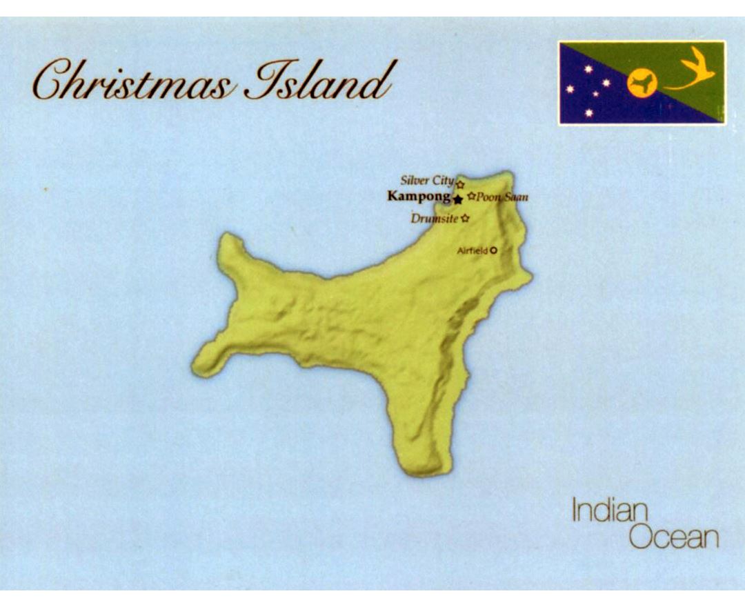
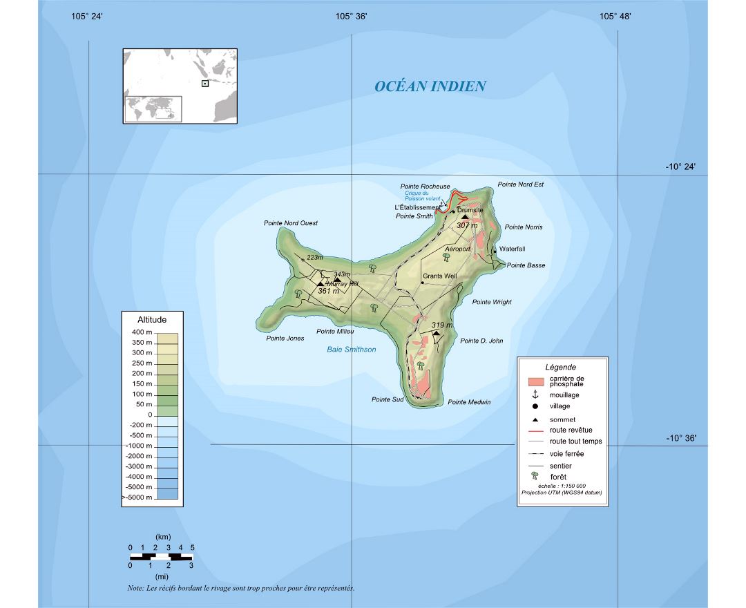
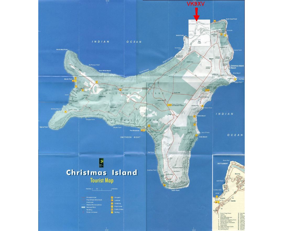
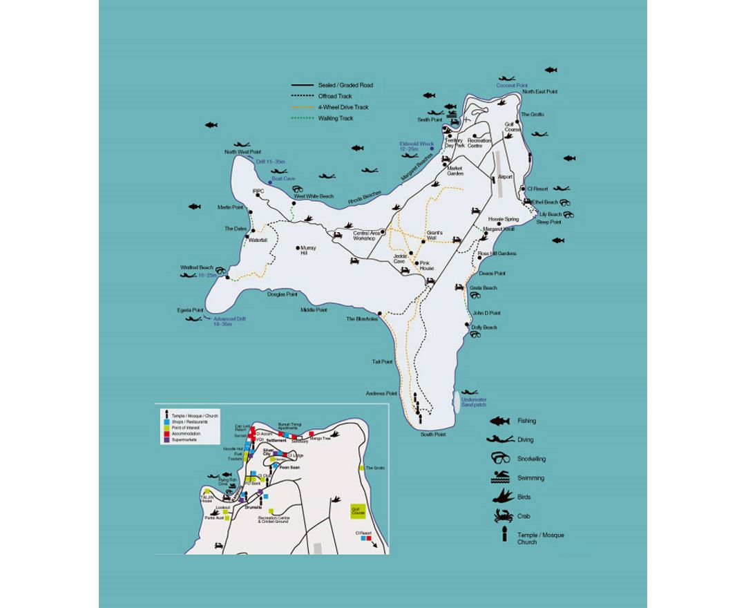
Christmas Island
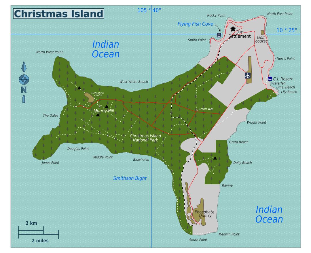
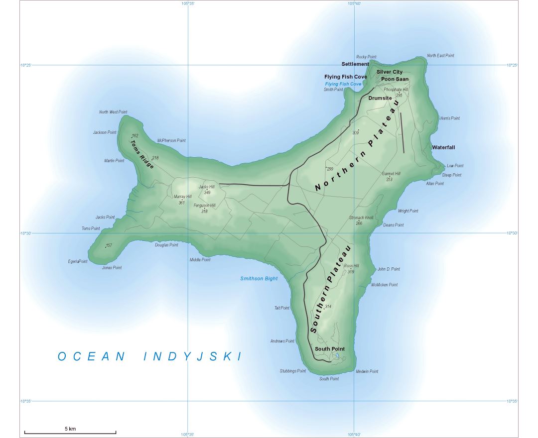
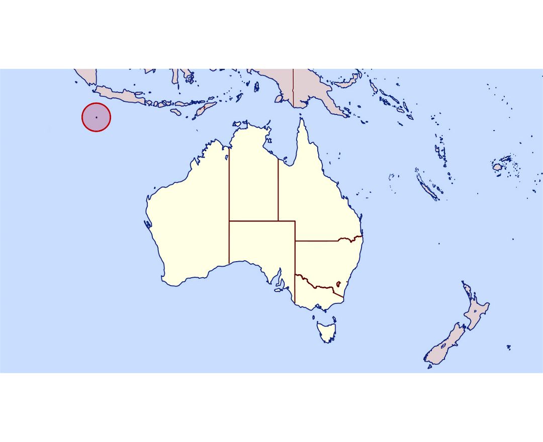
Christmas Island, officially the Territory of Christmas Island, is an external territory of the Commonwealth of Australia located in Christmas Island, comprising the island of the same name. It has a population of 2,072 residents, who live mainly in settlements on the northern tip of the island, including Flying Fish Cove (also known as Kampong), Silver City, Poon Saan, and Drumsite. Around two-thirds of the island's population are Malaysian Chinese, with significant numbers of Malays and European Australians as well as smaller numbers of Malaysian Indians and Eurasians. Several languages are in use, including English, Malay, and various Chinese dialects, while Buddhism is the primary religion, followed by three-quarters of the population.
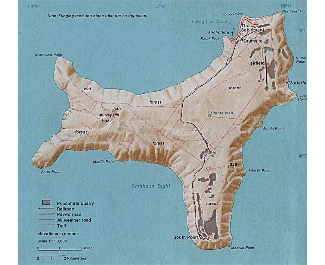
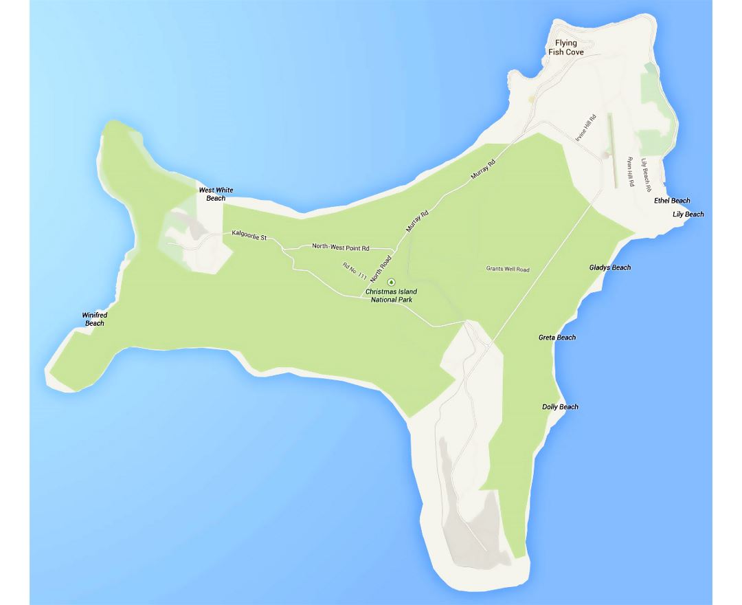
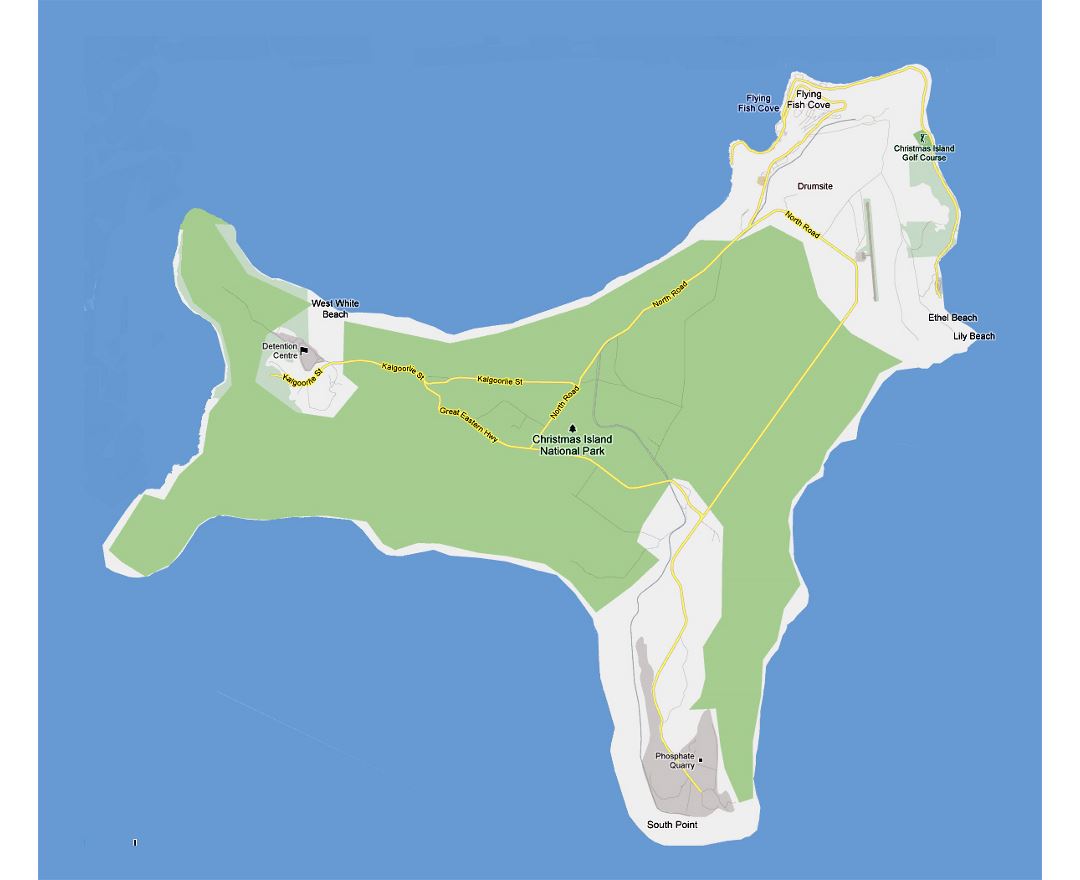
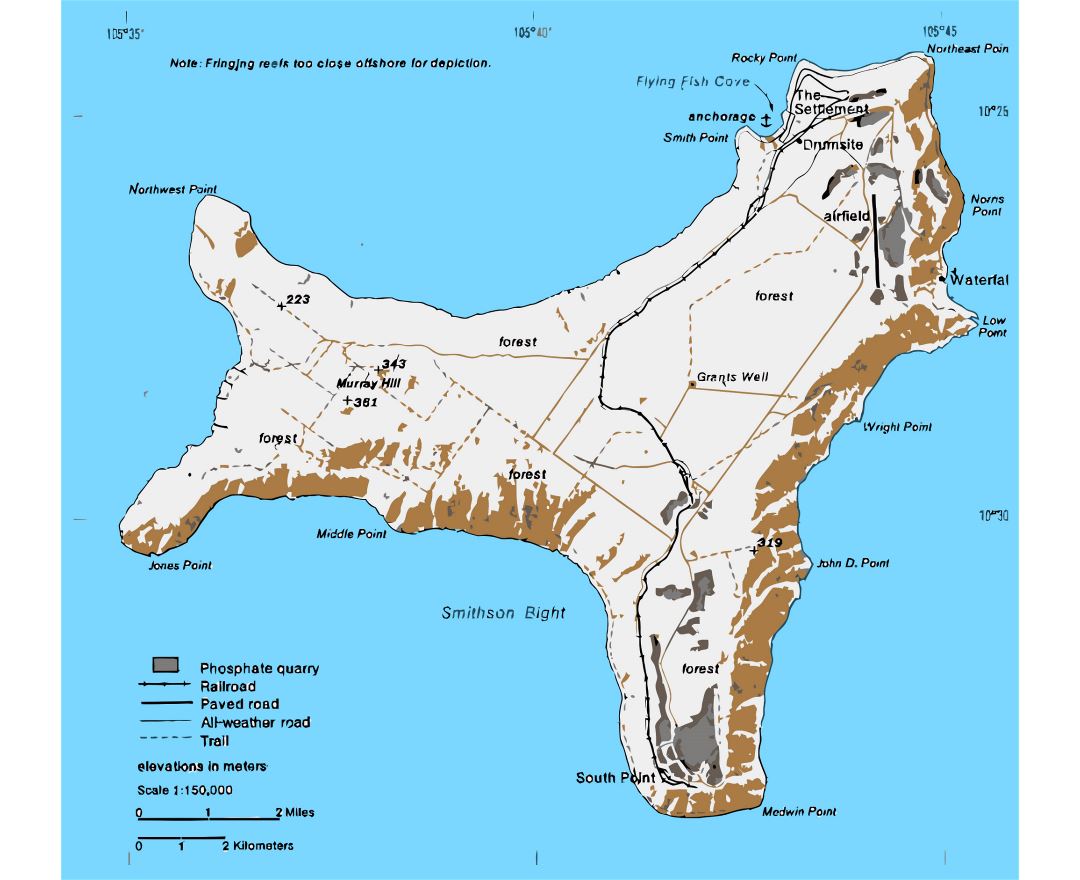
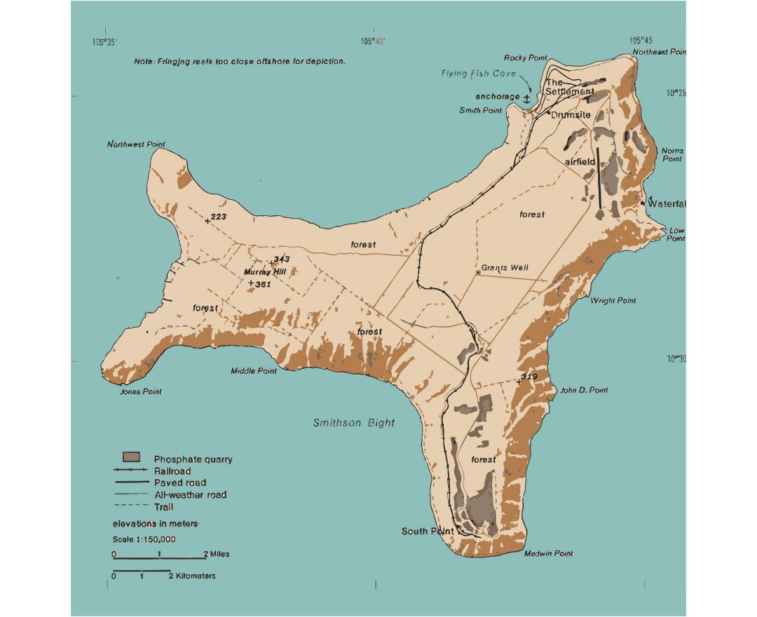
The island was discovered on Christmas Day (25 December) 1643, but only settled in the late 19th century. Its geographic isolation and history of minimal human disturbance has led to a high level of endemism among its flora and fauna, which is of interest to scientists and naturalists. 63% of its 135 square kilometres (52 sq mi) is an Australian national park. There exist large areas of primary monsoonal forest. Phosphate, deposited originally as guano, has been mined on the island for many years.