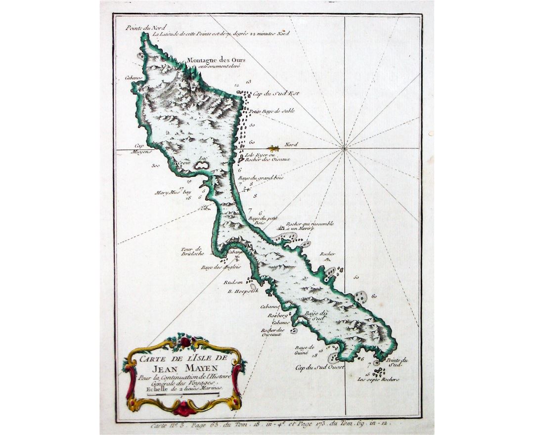
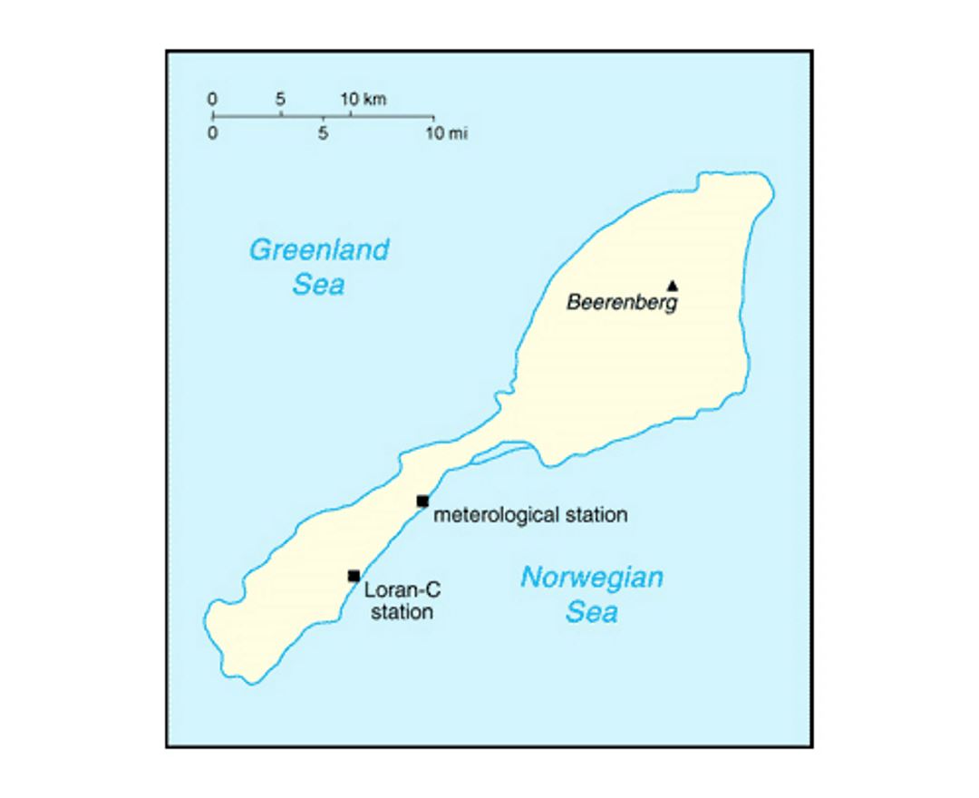
Jan Mayen
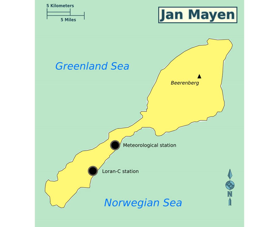
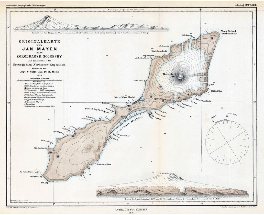
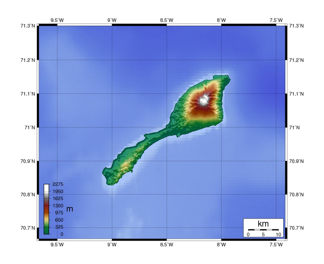
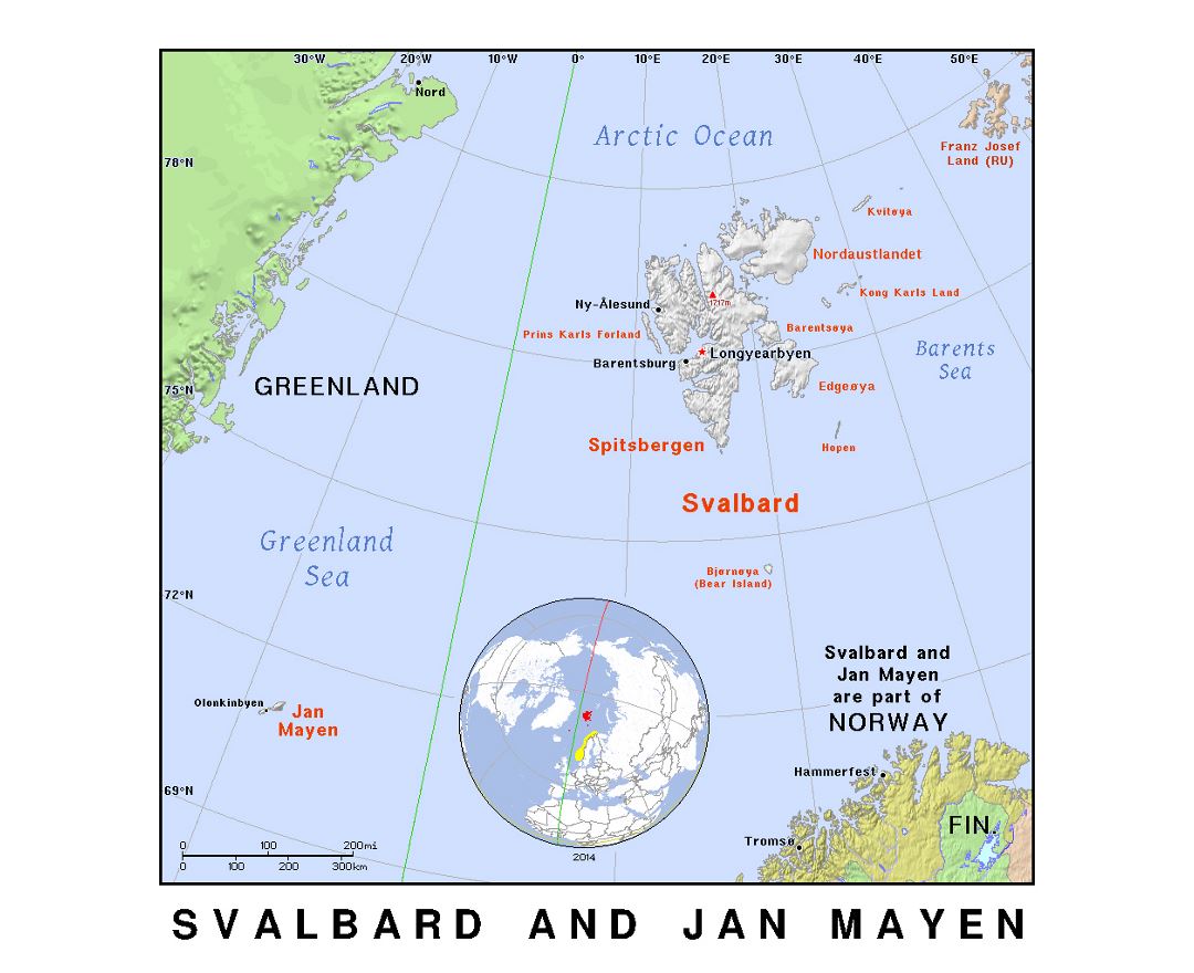
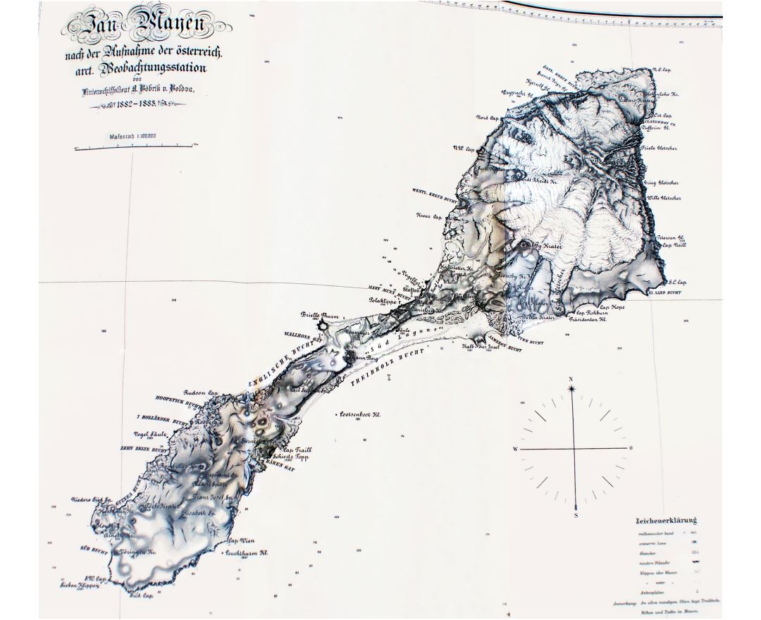
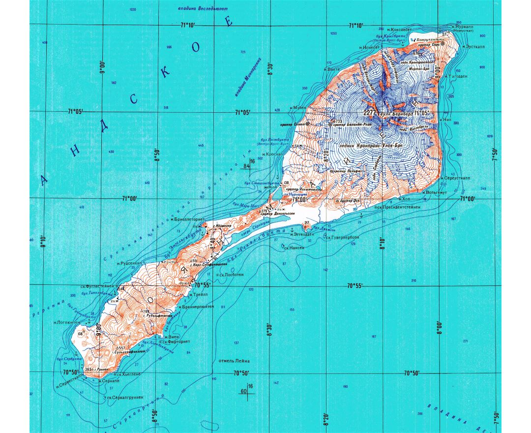
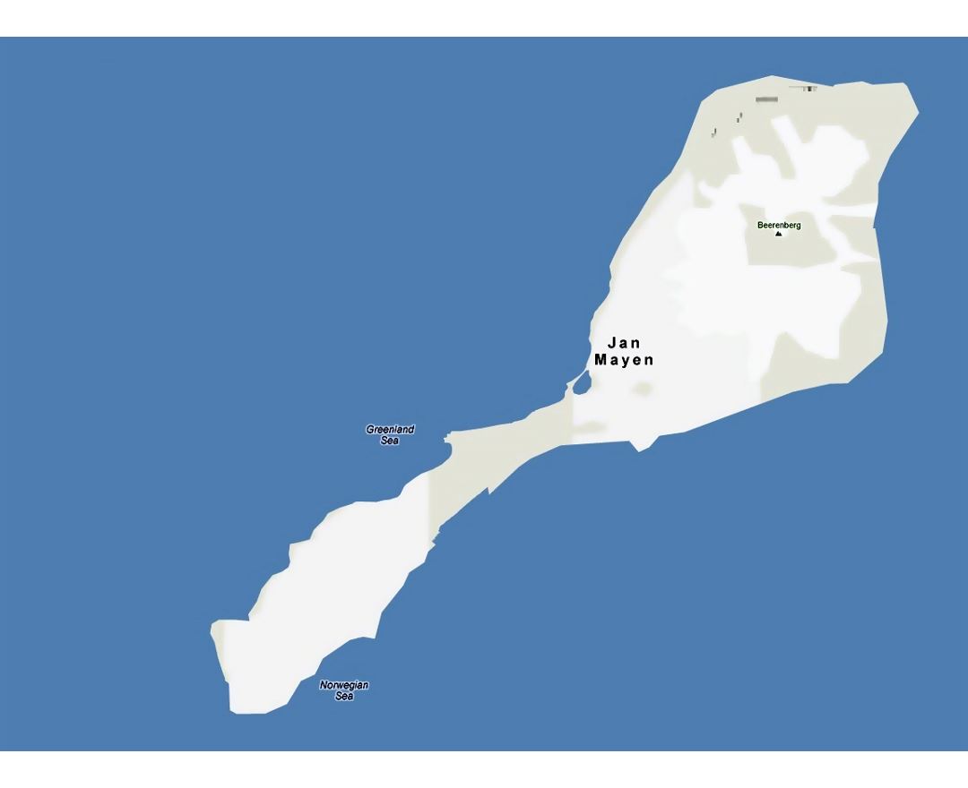
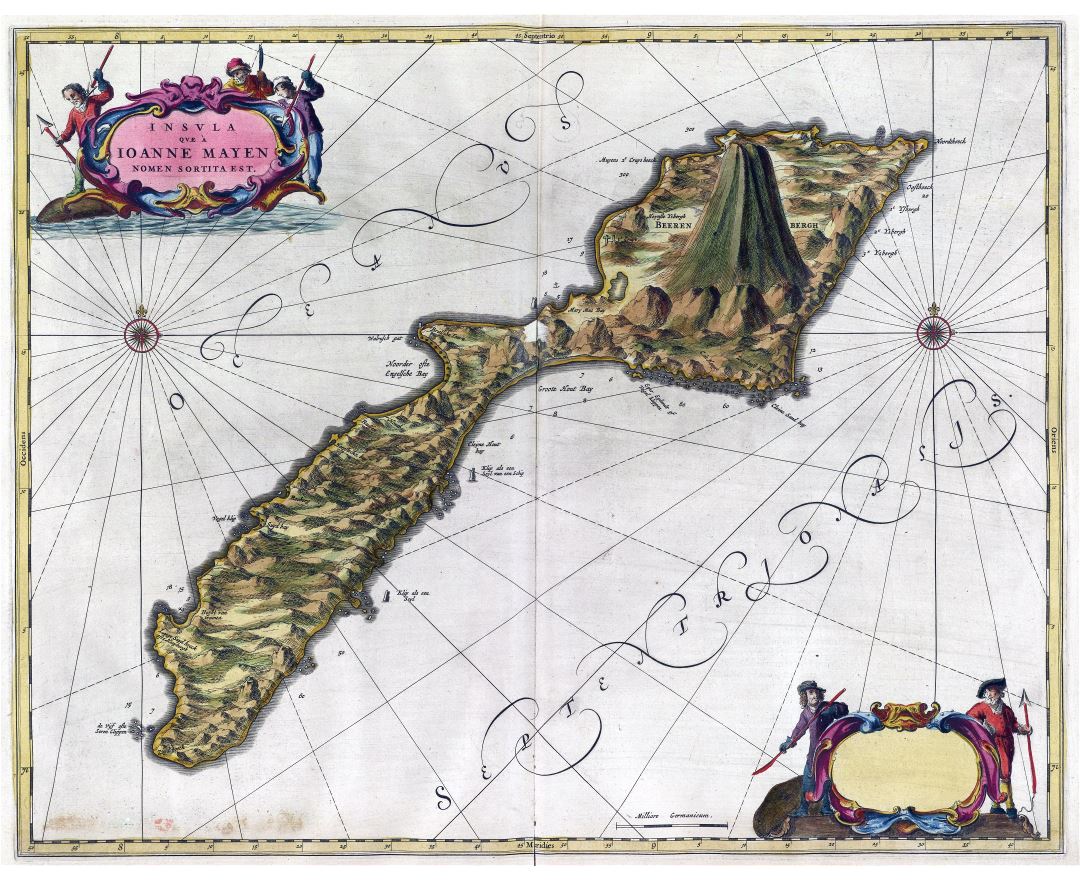
Jan Mayen is a volcanic island in the Arctic Ocean and a part of the Kingdom of Norway. It is 55 km (34 mi) long (southwest-northeast) and 373 km² (144 sq mi) in area, partly covered by glaciers (an area of 114.2 km (71.0 mi) around the Beerenberg volcano). It has two parts: larger northeast Nord-Jan and smaller Sor-Jan, linked by a 2.5 km (1.6 mi) wide isthmus. It lies 600 km (370 mi) northeast of Iceland (495 km (305 mi) NE of Kolbeinsey), 500 km (310 mi) east of central Greenland and 1,000 km (620 mi) west of the North Cape, Norway. The island is mountainous, the highest summit being the Beerenberg volcano in the north. The isthmus is the location of the two largest lakes of the island, Sørlaguna (South Lagoon), and Nordlaguna (North Lagoon). A third lake is called Ullerenglaguna (Ullereng Lagoon). Jan Mayen was formed by the Jan Mayen hotspot.
Although administered separately, Svalbard and Jan Mayen are collectively assigned the ISO 3166-1 alpha-2 country code "SJ".