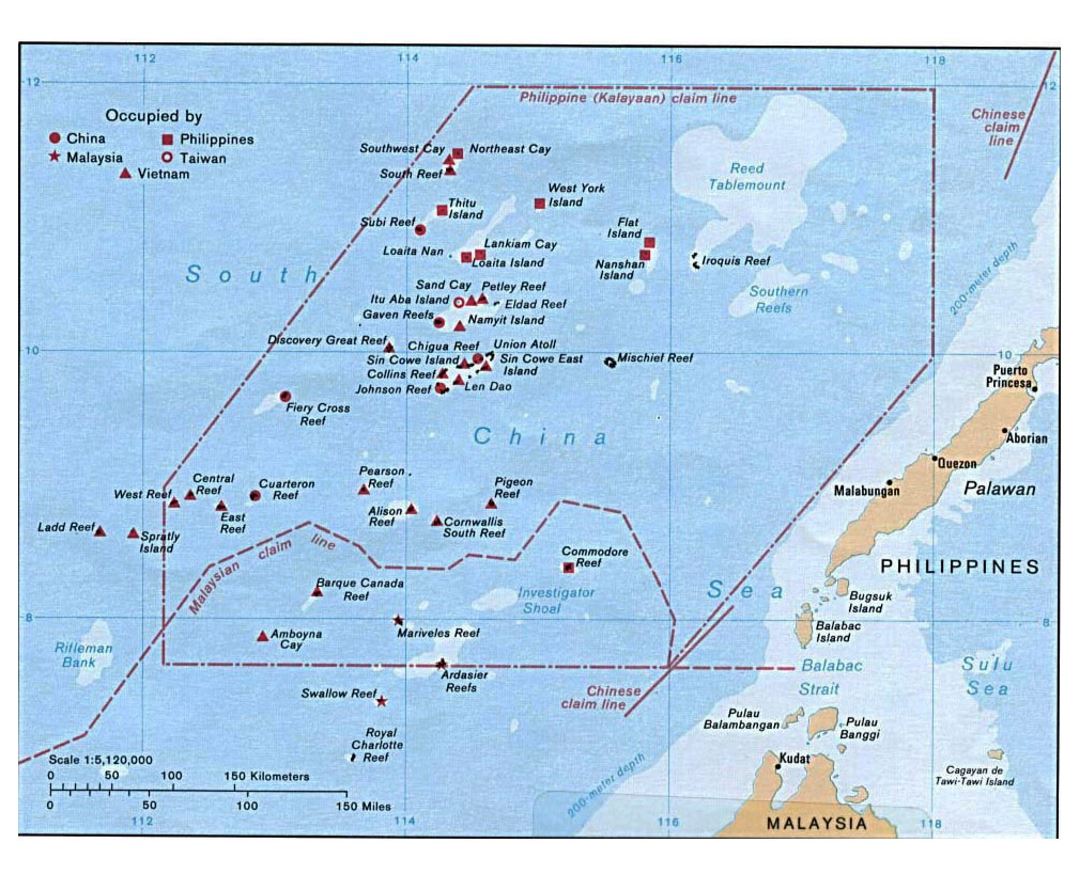
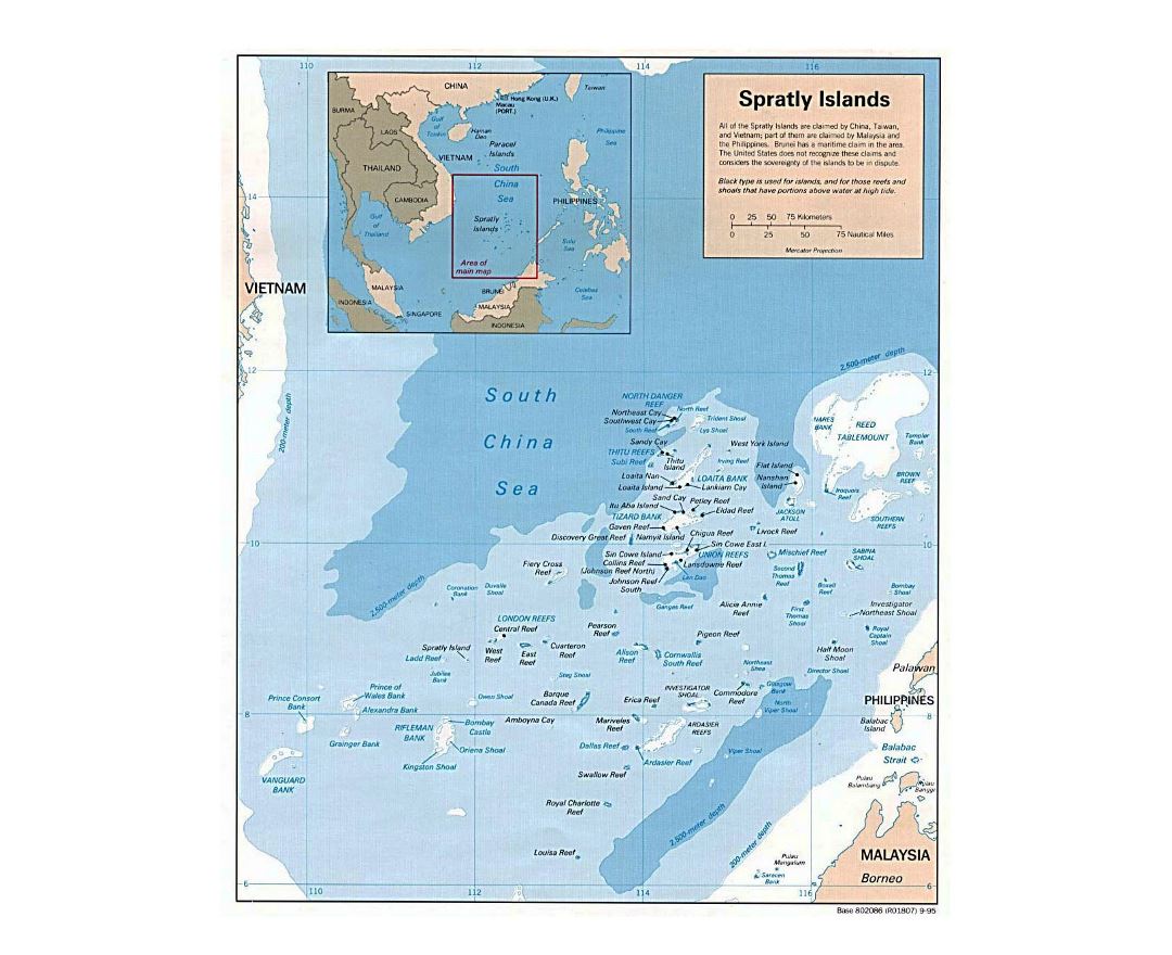
Spratly Islands
The Spratly Islands are a disputed group of 14 islands, islets and cays and more than 100 reefs, sometimes grouped in submerged old atolls, in the South China Sea. The archipelago lies off the coasts of the Philippines, Malaysia, and southern Vietnam. Named after the 19th-century British whaling captain Richard Spratly who sighted Spratly Island in 1843, the islands contain approximately 2 km² (490 acres) of land area spread over a vast area of more than 425,000 km² (164,000 sq mi).
The Spratlys are one of the major archipelagos in the South China Sea which complicate governance and economics in this part of Southeast Asia due to their location in strategic shipping lanes. The islands have no indigenous inhabitants, but offer rich fishing grounds and may contain significant oil and natural gas reserves, and as such are important to the claimants in their attempts to establish international boundaries. Some of the islands have civilian settlements, but of the approximately 45 islands, cays, reefs and shoals that are occupied, all contain structures that are occupied by military forces from Malaysia, Taiwan (ROC), China (PRC), the Philippines and Vietnam. Additionally, Brunei has claimed an exclusive economic zone in the southeastern part of the Spratlys, which includes the Louisa Reef.