Central America and the Caribbean
Central America
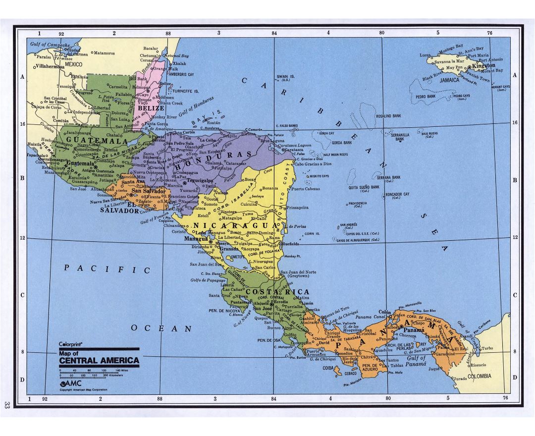
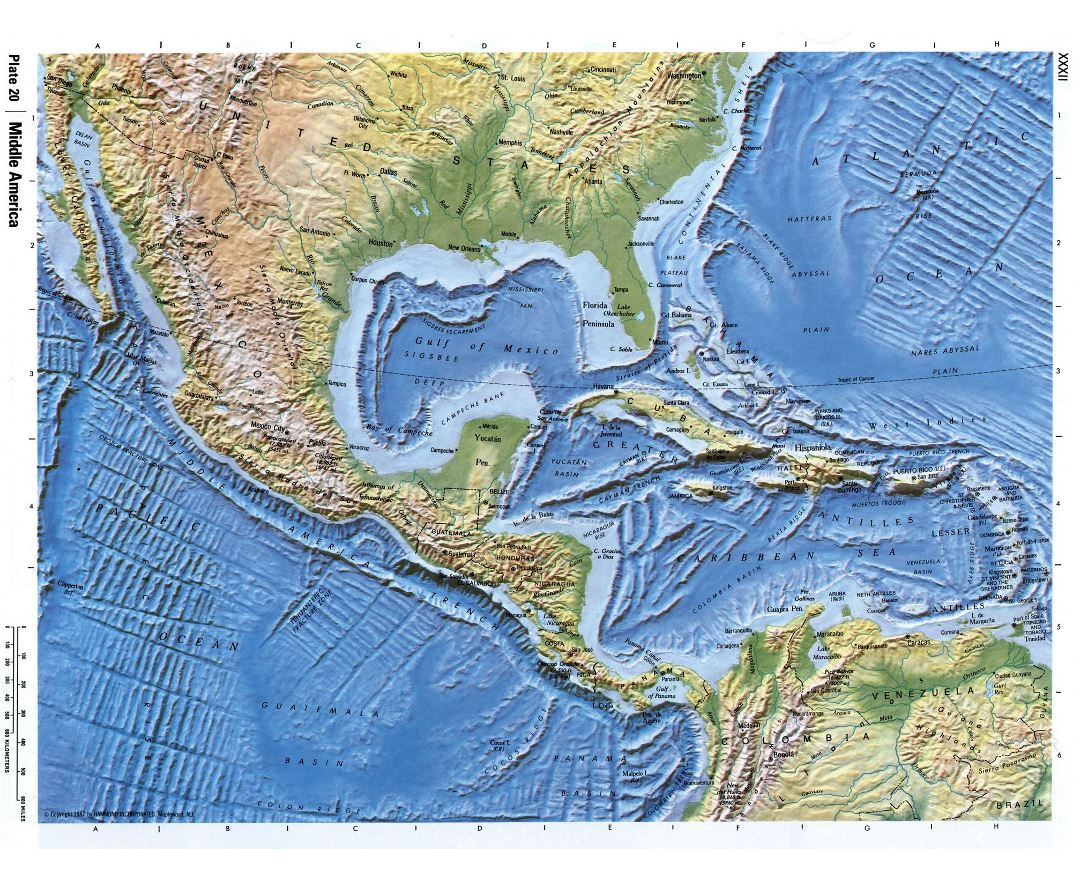
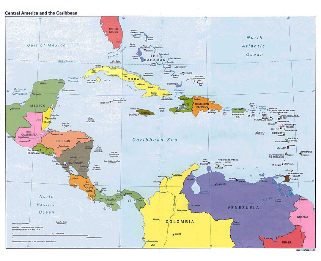
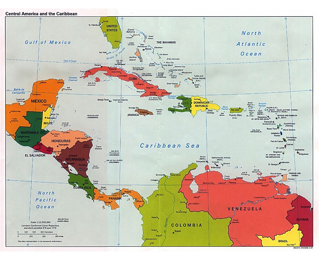
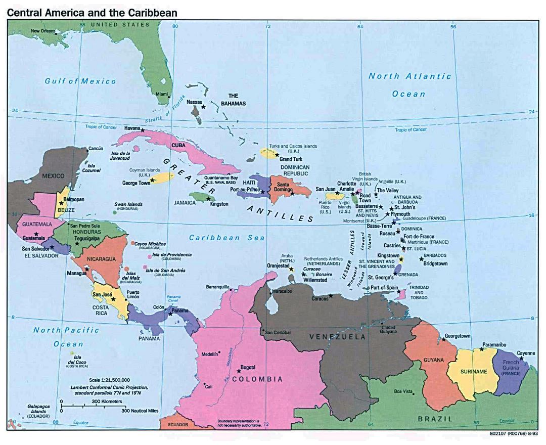
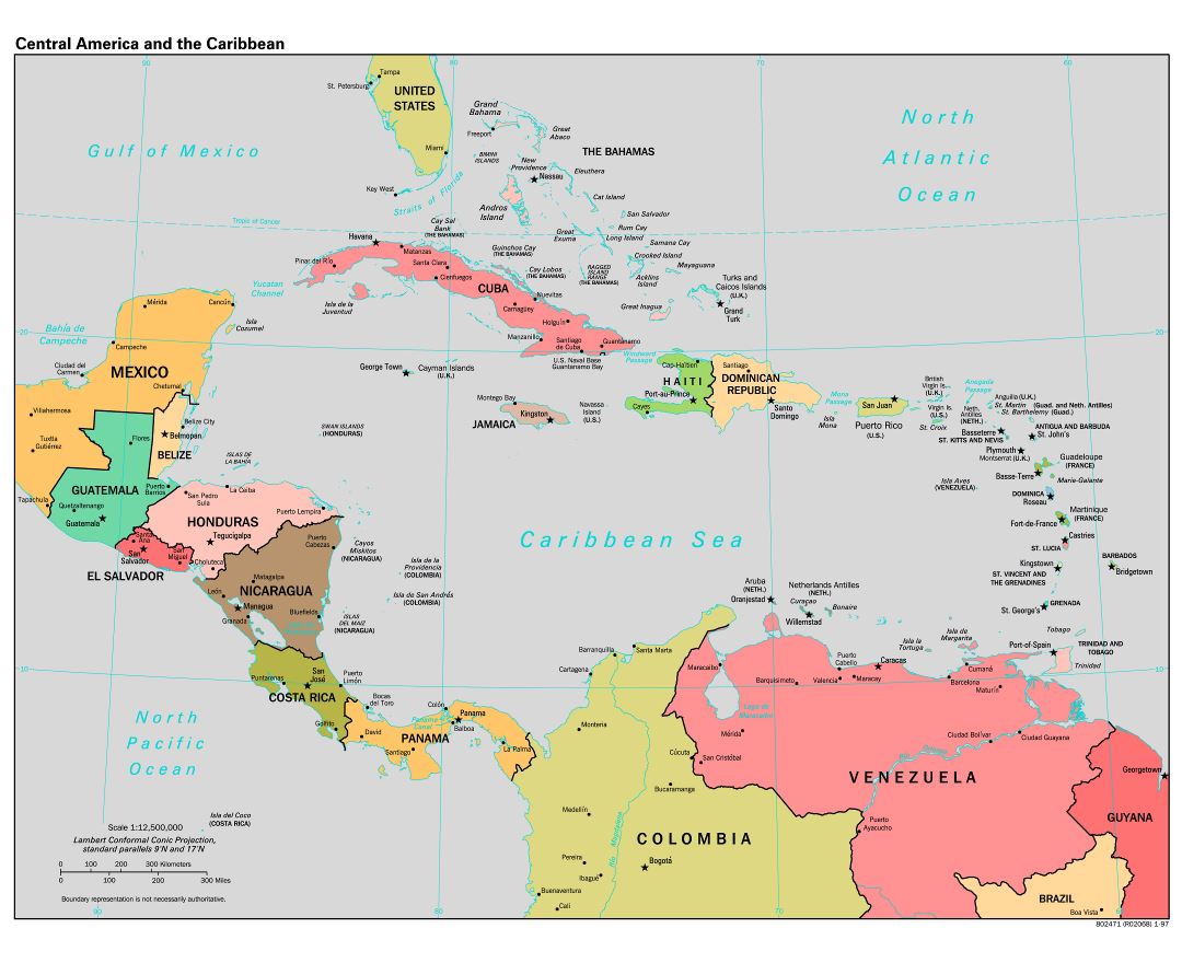
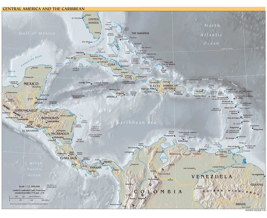
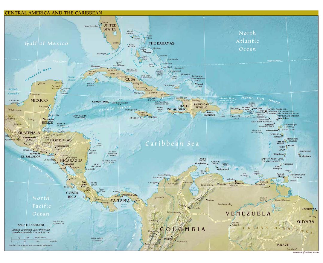
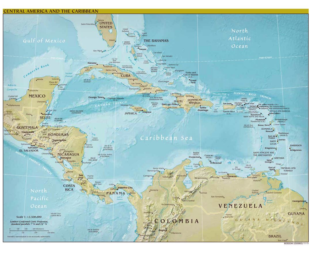
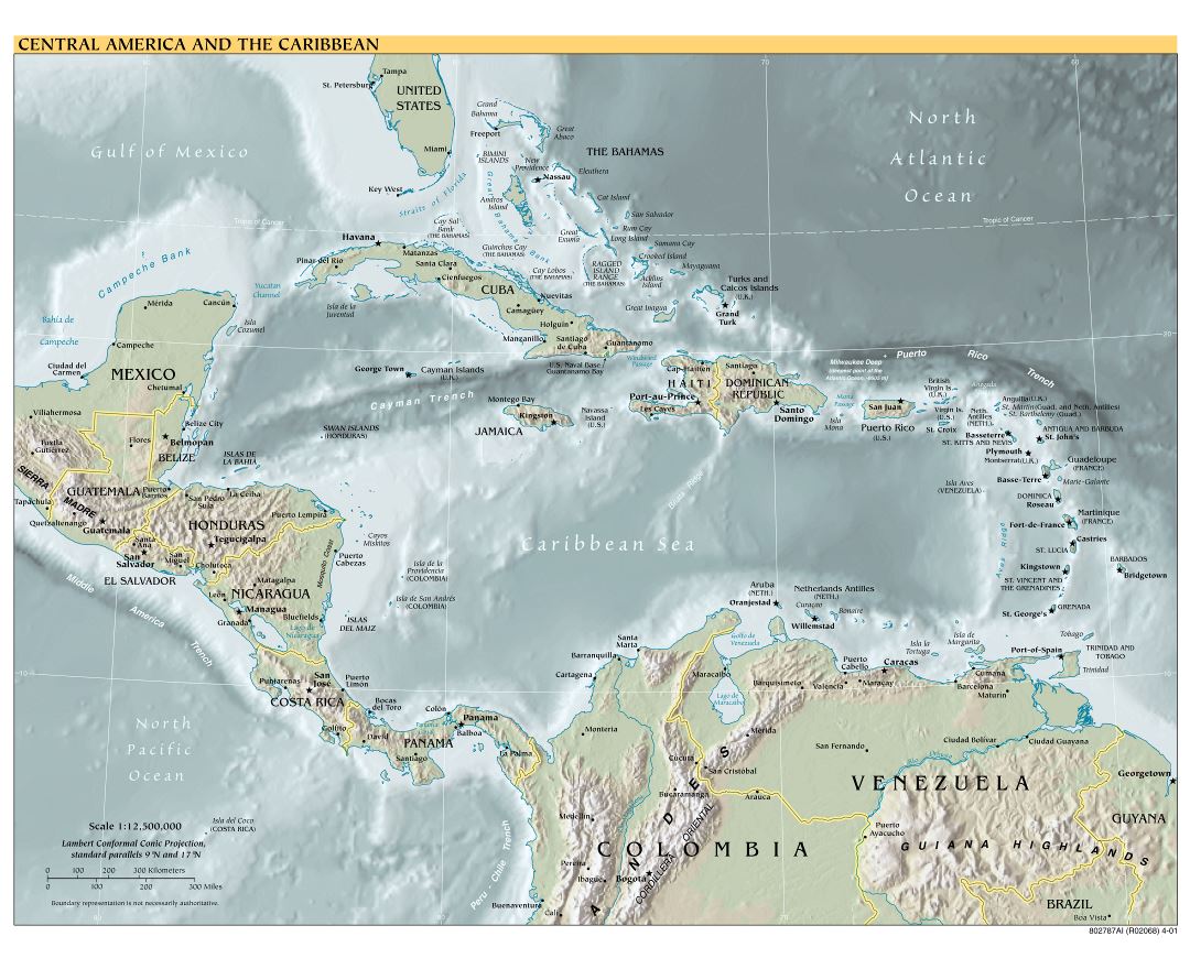
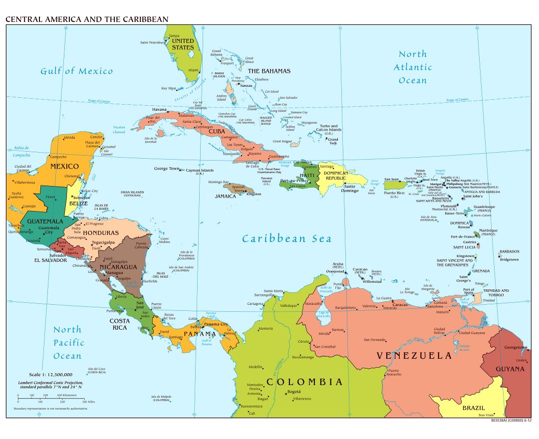
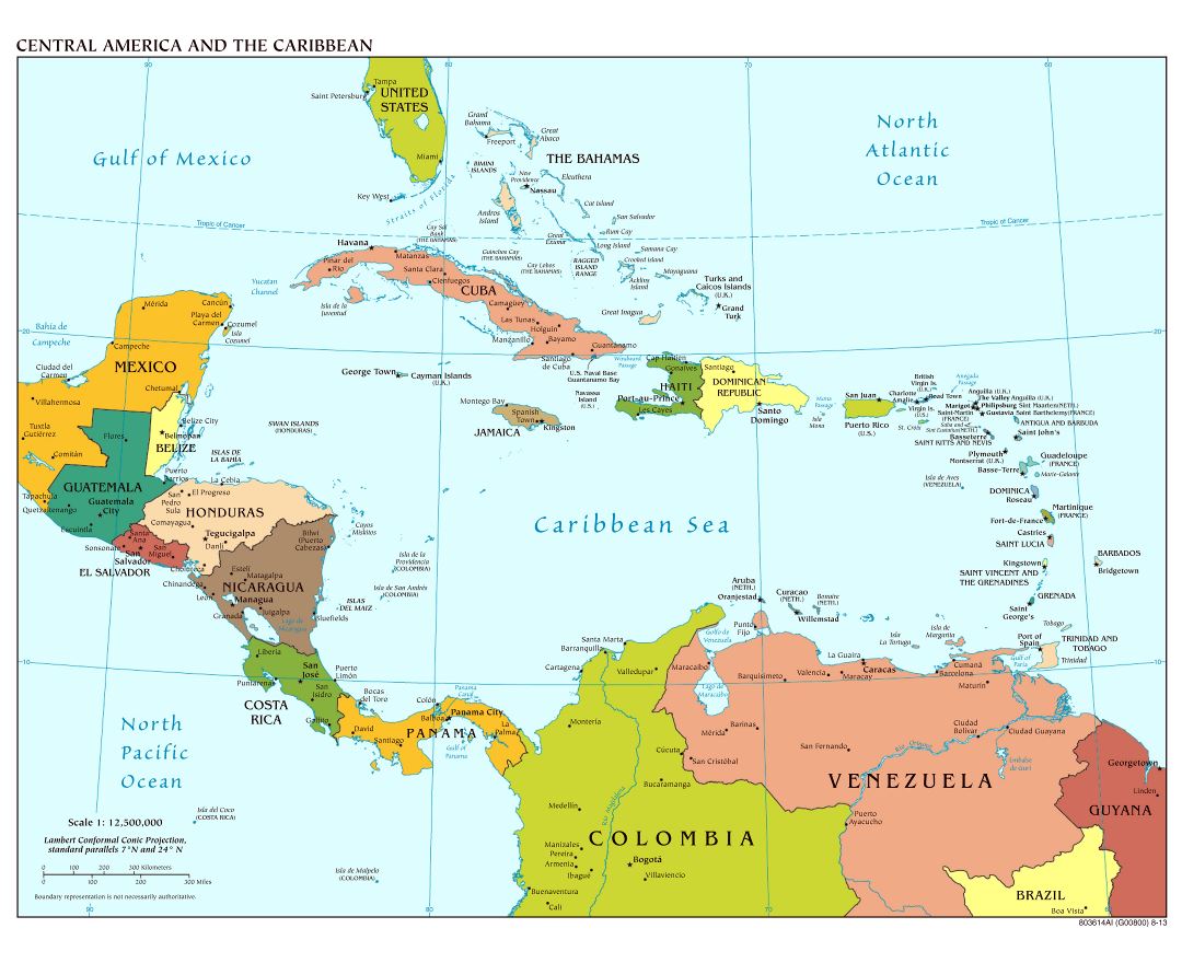
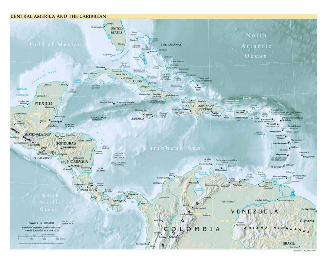
Central America is the southernmost, isthmian portion of the North American continent, which connects with South America on the southeast. Central America is bordered by Mexico to the north, Colombia to the southeast, the Caribbean Sea to the east, and the Pacific Ocean to the west. Central America consists of seven countries: Belize, Costa Rica, El Salvador, Guatemala, Honduras, Nicaragua, and Panama. The combined population of Central America is between 41,739,000 (2009 estimate) and 42,688,190 (2012 estimate).
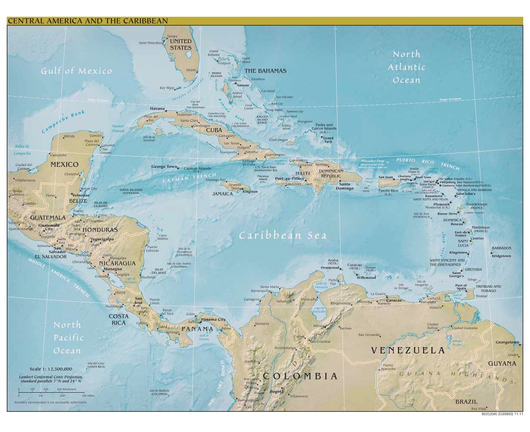
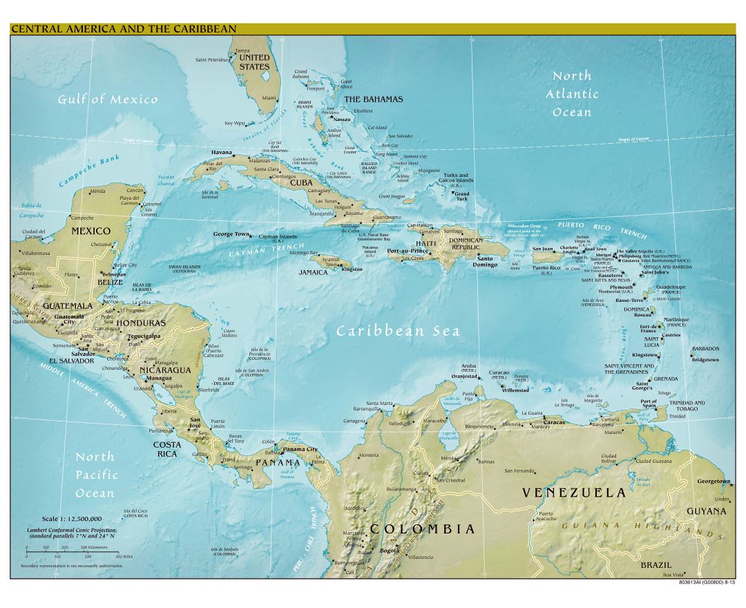
The Central American land mass has an area of 523,780 square kilometers (202,230 sq mi), or almost 0.1% of the Earth's surface. It is part of the Mesoamerican biodiversity hotspot, which extends from northern Guatemala through central Panama. Due to the presence of several active geologic faults and the Central America Volcanic Arc, there is a great deal of seismic activity in the region. Volcanic eruptions and earthquakes occur frequently, these natural disasters have resulted in the loss of many lives and much property.
In the Pre-Columbian era, Central America was inhabited by the indigenous peoples of Mesoamerica to the north and west and the Isthmo-Colombian peoples to the south and east. Soon after Christopher Columbus's voyages to the Americas, the Spanish began to colonize the Americas. From 1609 until 1821, most of the territory within Central America - except for the lands that would become Belize and Panama - was governed as the Captaincy General of Guatemala. After achieving independence from Spain in 1821, the former Captaincy General was annexed to the First Mexican Empire, but soon seceded from Mexico to form the Federal Republic of Central America, which lasted from 1823 to 1838. The seven states finally became independent autonomous nations, beginning with Nicaragua, Honduras, Costa Rica, and Guatemala (1838), followed by El Salvador (1841), then Panama (1903), and finally Belize (1981).
Caribbean
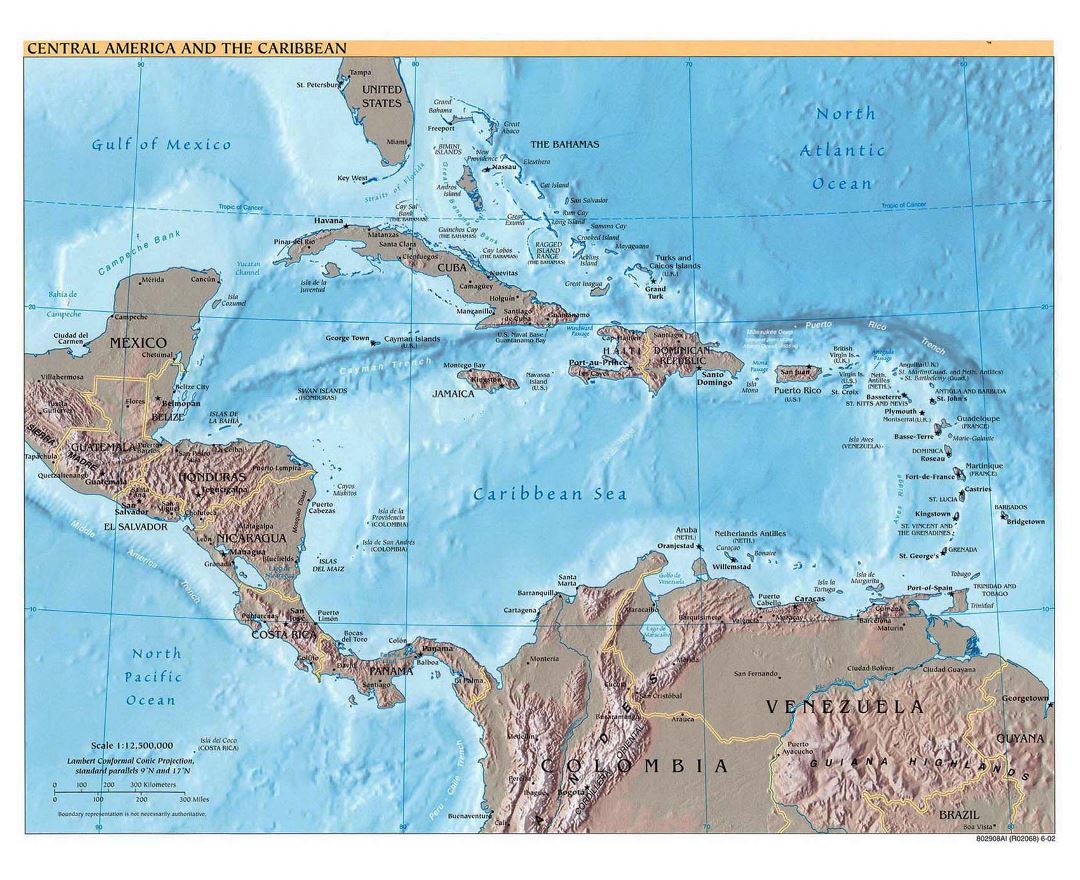
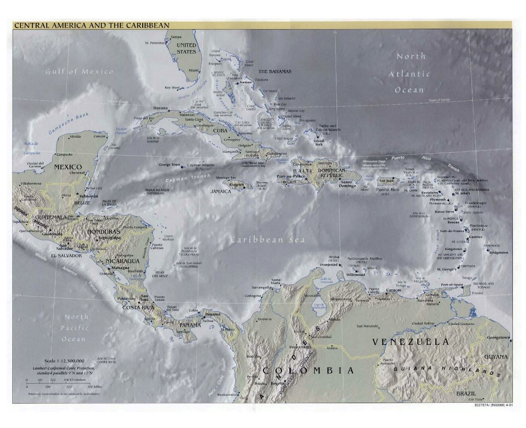
The Caribbean is a region that consists of the Caribbean Sea, its islands (some surrounded by the Caribbean Sea and some bordering both the Caribbean Sea and the North Atlantic Ocean), and the surrounding coasts. The region is southeast of the Gulf of Mexico and the North American mainland, east of Central America, and north of South America.
Situated largely on the Caribbean Plate, the region comprises more than 700 islands, islets, reefs, and cays. These islands generally form island arcs that delineate the eastern and northern edges of the Caribbean Sea. The Caribbean islands, consisting of the Greater Antilles on the north and the Lesser Antilles on the south and east (including the Leeward Antilles), are part of the somewhat larger West Indies grouping, which also includes the Lucayan Archipelago (comprising The Bahamas and Turks and Caicos Islands) north of the Greater Antilles and Caribbean Sea. In a wider sense, the mainland countries of Belize, Venezuela, Guyana, Suriname, and French Guiana are also included.
Geopolitically, the Caribbean islands are usually regarded as a subregion of North America and are organized into 30 territories including sovereign states, overseas departments, and dependencies. From December 15, 1954, to October 10, 2010 there was a country known as the Netherlands Antilles composed of five states, all of which were Dutch dependencies. While from January 3, 1958, to May 31, 1962, there was also a short-lived country called the Federation of the West Indies composed of ten English-speaking Caribbean territories, all of which were then British dependencies. The West Indies cricket team continues to represent many of those nations.