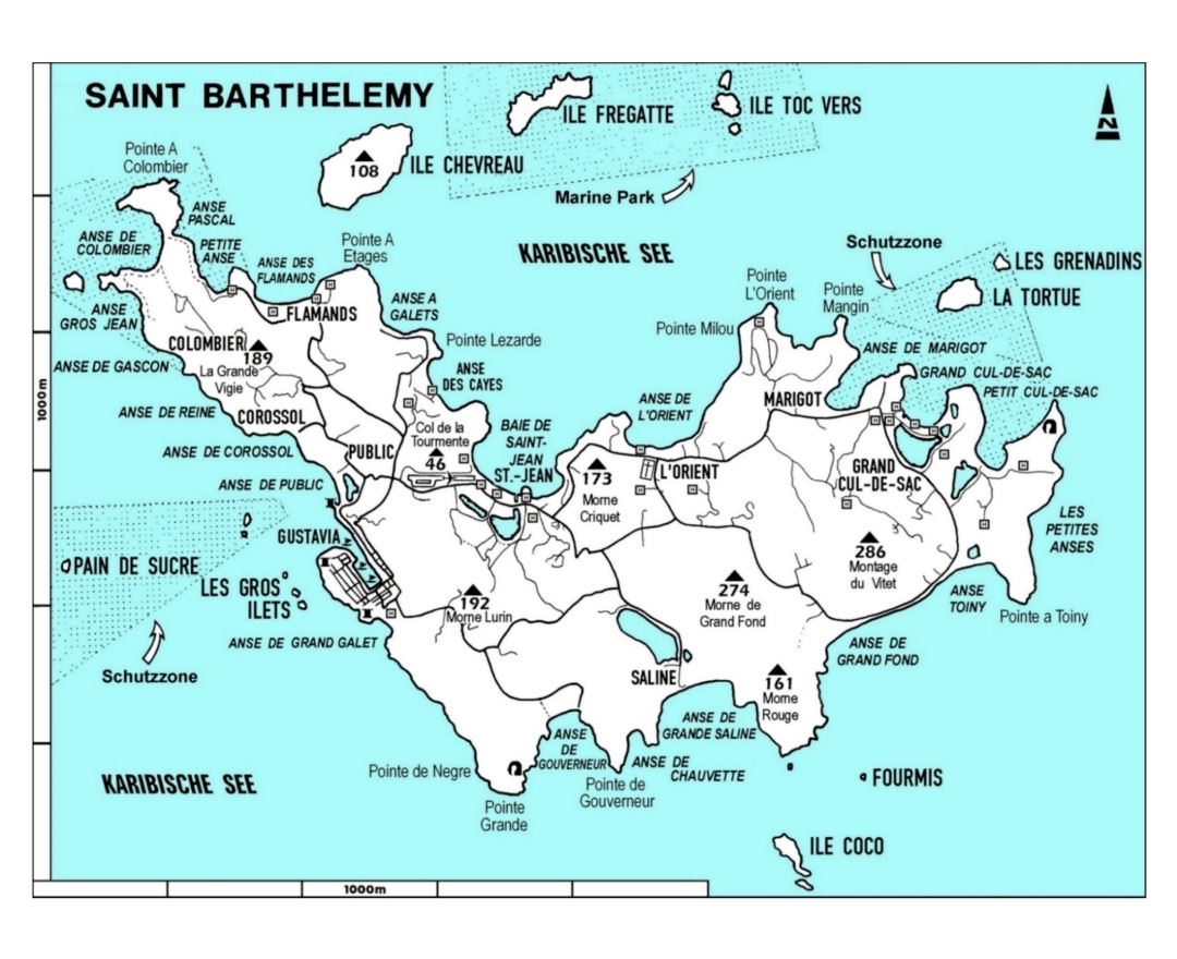
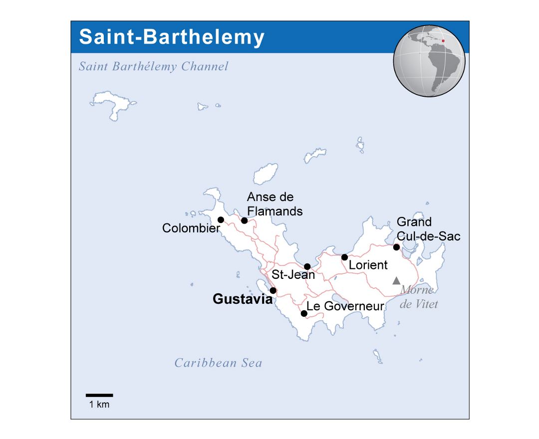
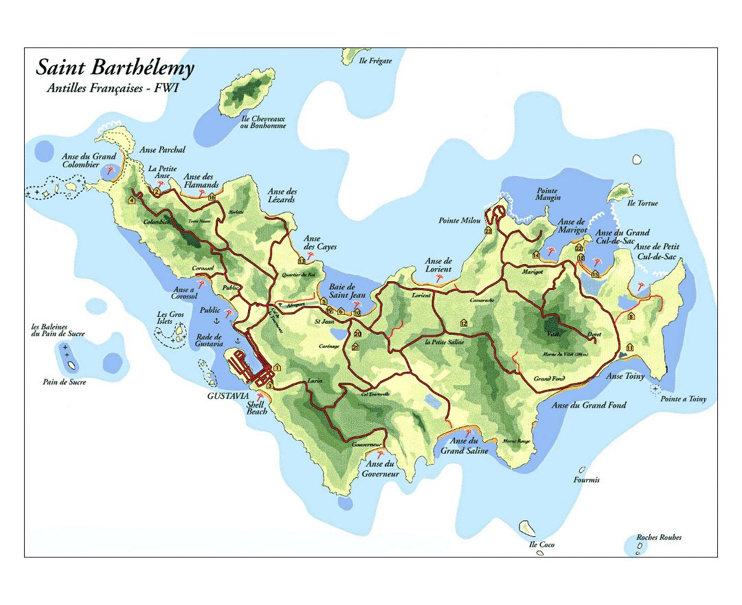
Saint Barthelemy
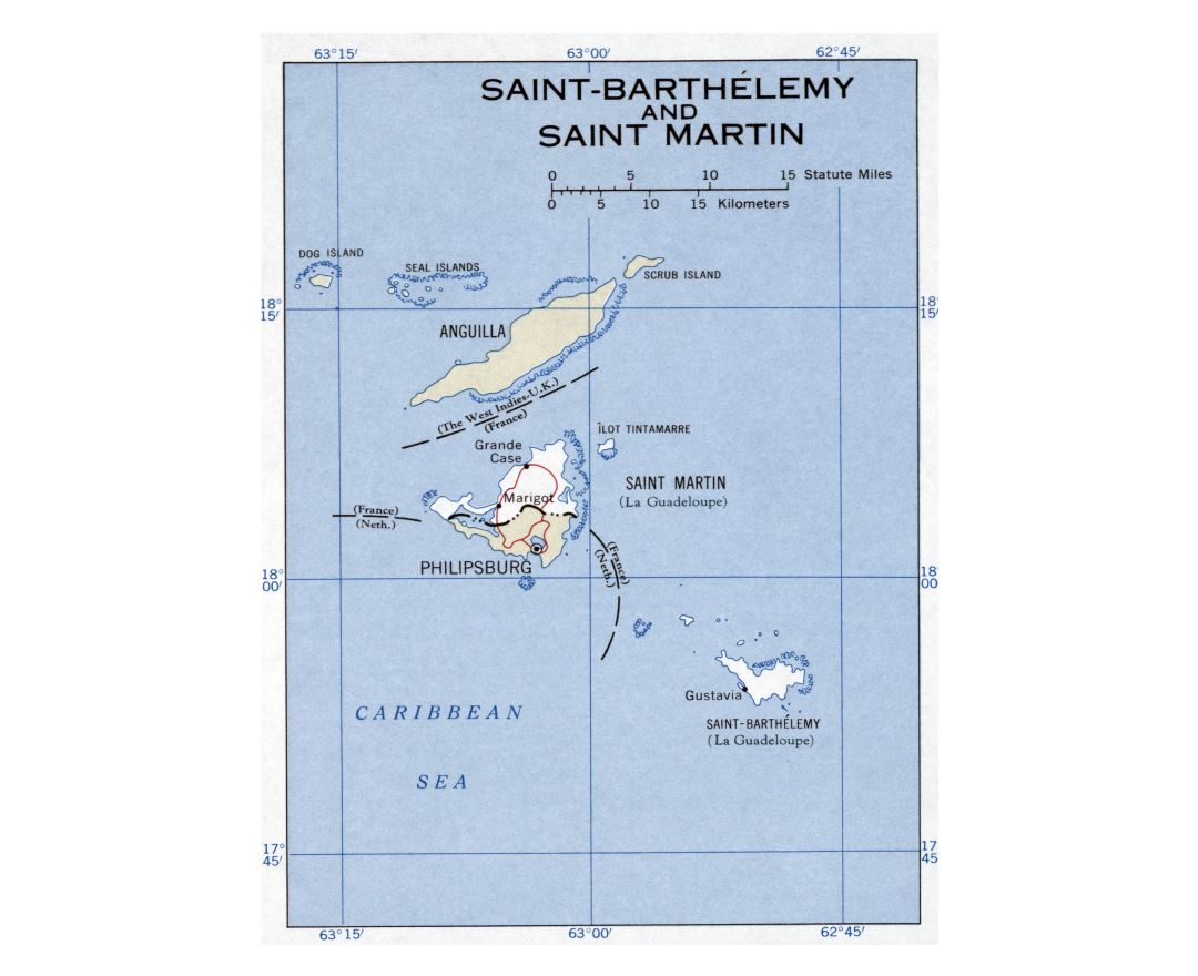
Saint Barthelemy, officially the Territorial collectivity of Saint-Barthelemy, called Ouanalao by the indigenous people, is an overseas collectivity of France in the West Indies. Often abbreviated to St-Barth in French, and St. Barths or St. Barts in English, the island lies about 35 kilometres (22 mi) southeast of St. Martin and north of St. Kitts. Puerto Rico is 240 kilometres (150 mi) to the west in the Greater Antilles.
Saint Barthelemy was for many years a French commune forming part of Guadeloupe, which is an overseas region and department of France. In 2003, the island voted in favour of secession from Guadeloupe in order to form a separate overseas collectivity (COM) of France. The collectivity is one of four territories among the Leeward Islands in the northeastern Caribbean that comprise the French West Indies, along with Saint Martin, Guadeloupe (200 kilometres (120 mi) southeast), and Martinique.
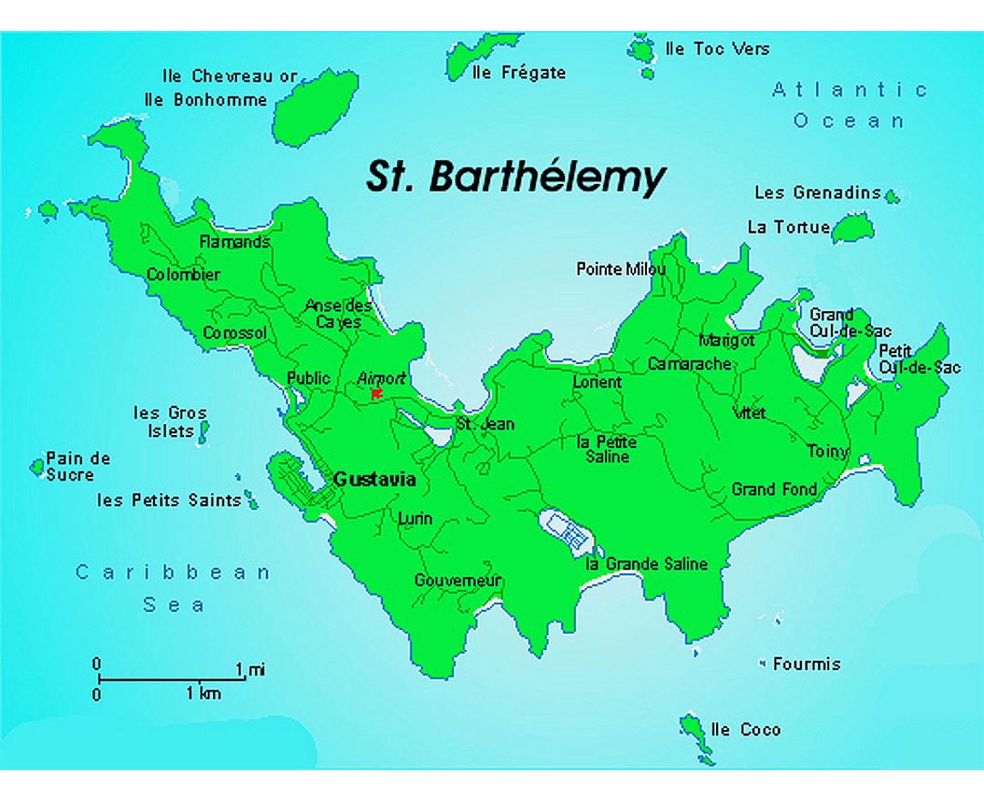
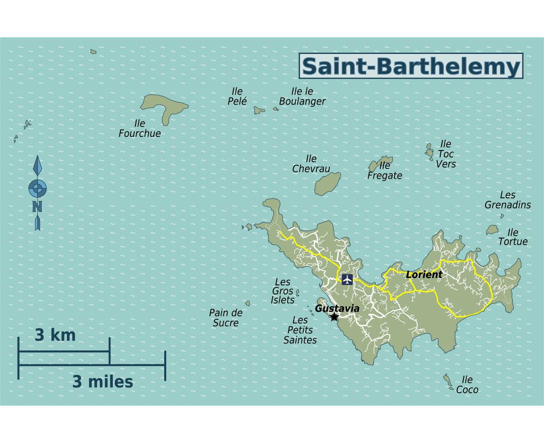
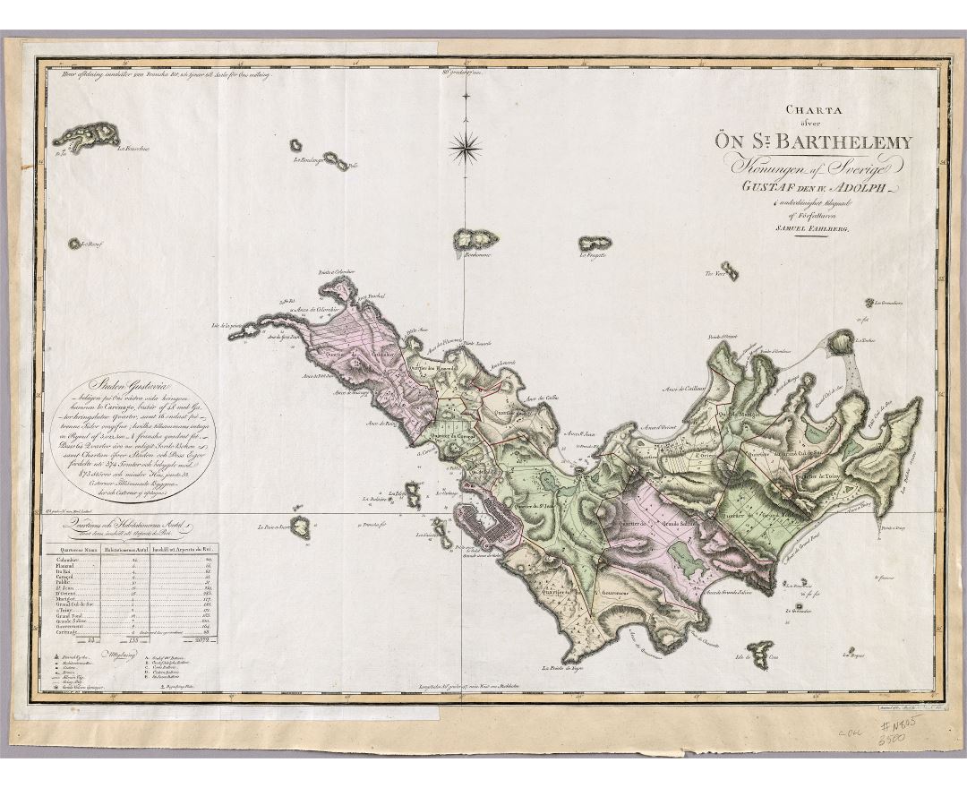
Saint Barthélemy, a volcanic island fully encircled by shallow reefs, has an area of 25 square kilometres (9.7 sq mi) and a population of 9,278 (Jan. 2013 census). Its capital is Gustavia, which also contains the main harbour to the island. It is the only Caribbean island which was a Swedish colony for any significant length of time; Guadeloupe was under Swedish rule only briefly at the end of the Napoleonic Wars. Symbolism from the Swedish national arms, the Three Crowns, still appears in the island's coat of arms. The language, cuisine, and culture, however, are distinctly French. The island is a popular tourist destination during the winter holiday season, especially for the rich and famous during the Christmas and new year period.