Howland Island
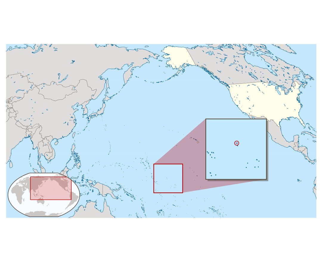
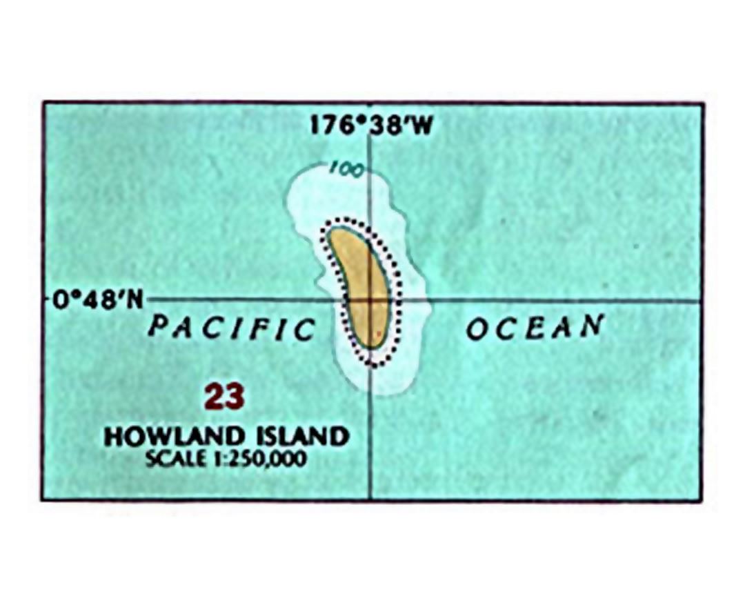
Howland Island is an uninhabited coral island located just north of the equator in the central Pacific Ocean, about 1,700 nautical miles (3,100 km) southwest of Honolulu. The island lies almost halfway between Hawaii and Australia and is an unincorporated, unorganized territory of the United States. Geographically, together with Baker Island it forms part of the Phoenix Islands. For statistical purposes, Howland is grouped as one of the United States Minor Outlying Islands.
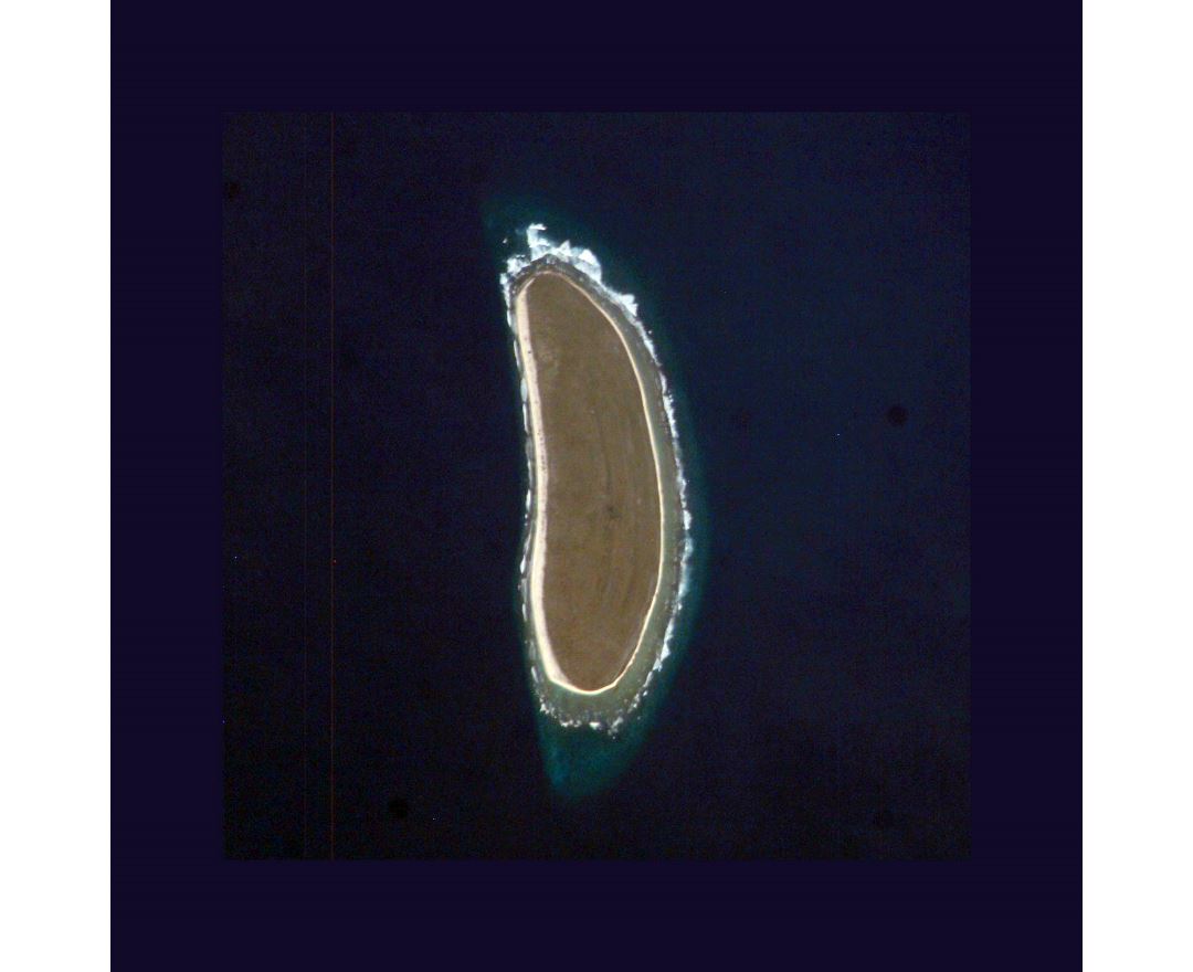
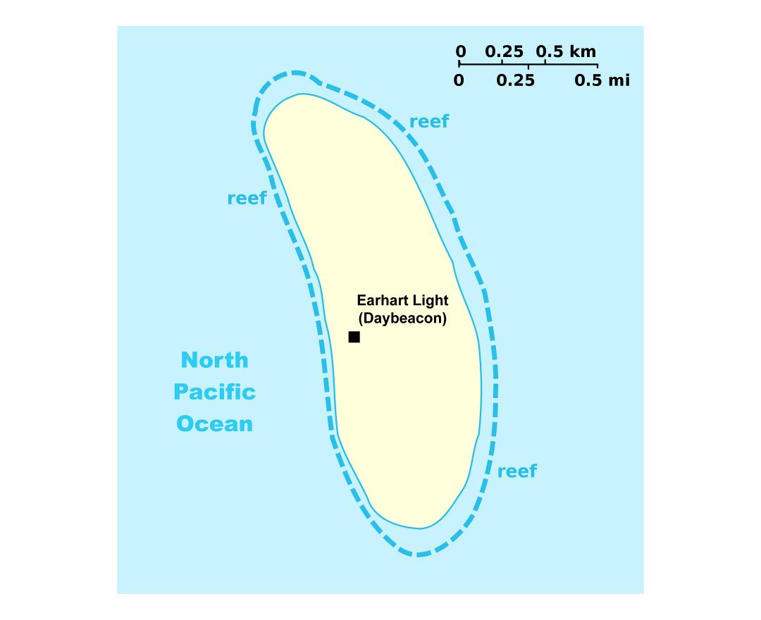
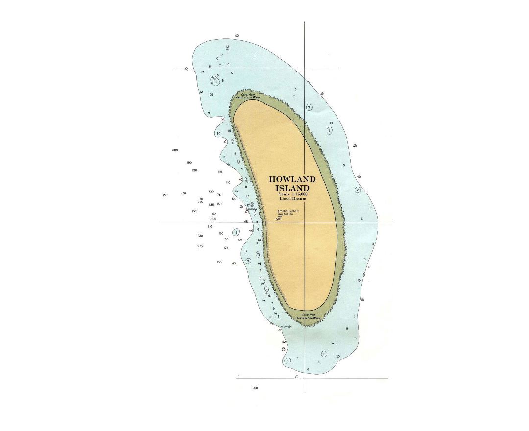
Howland is located at 0°48′25.84″N 176°36′59.48″W. It covers 1,112 acres (4.50 km²), with 4 miles (6.4 km) of coastline. The island has an elongated plantain-shape on a north - south axis. There is no lagoon.
Howland Island National Wildlife Refuge consists of the entire island and the surrounding 32,074 acres (129.80 km²) of submerged land. The island is managed by the U.S. Fish and Wildlife Service as an insular area under the U.S. Department of the Interior and is part of the Pacific Remote Islands Marine National Monument.
The atoll has no economic activity. It is perhaps best known as the island Amelia Earhart was searching for but never reached when her airplane disappeared on July 2, 1937, during her planned round-the-world flight. Airstrips constructed to accommodate her planned stopover were subsequently damaged, were not maintained and gradually disappeared. There are no harbors or docks. The fringing reefs may pose a maritime hazard. There is a boat landing area along the middle of the sandy beach on the west coast, as well as a crumbling day beacon. The island is visited every two years by the U.S. Fish and Wildlife Service.