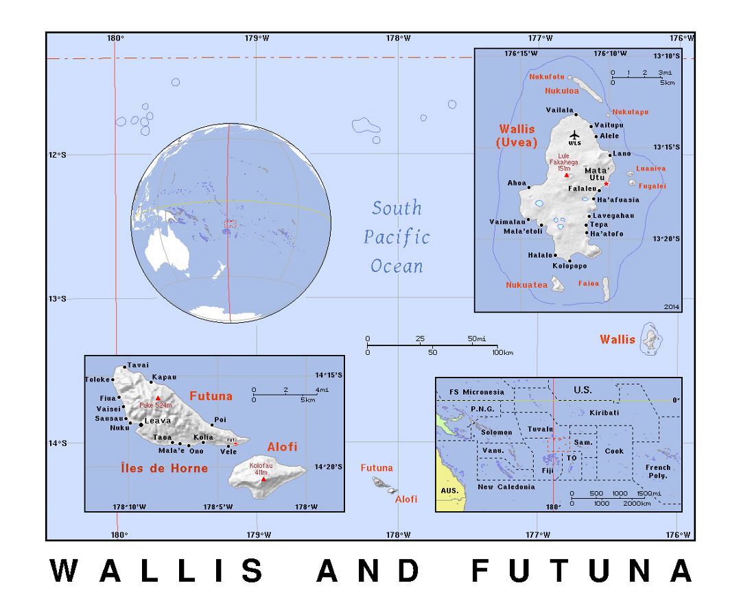
Wallis and Futuna
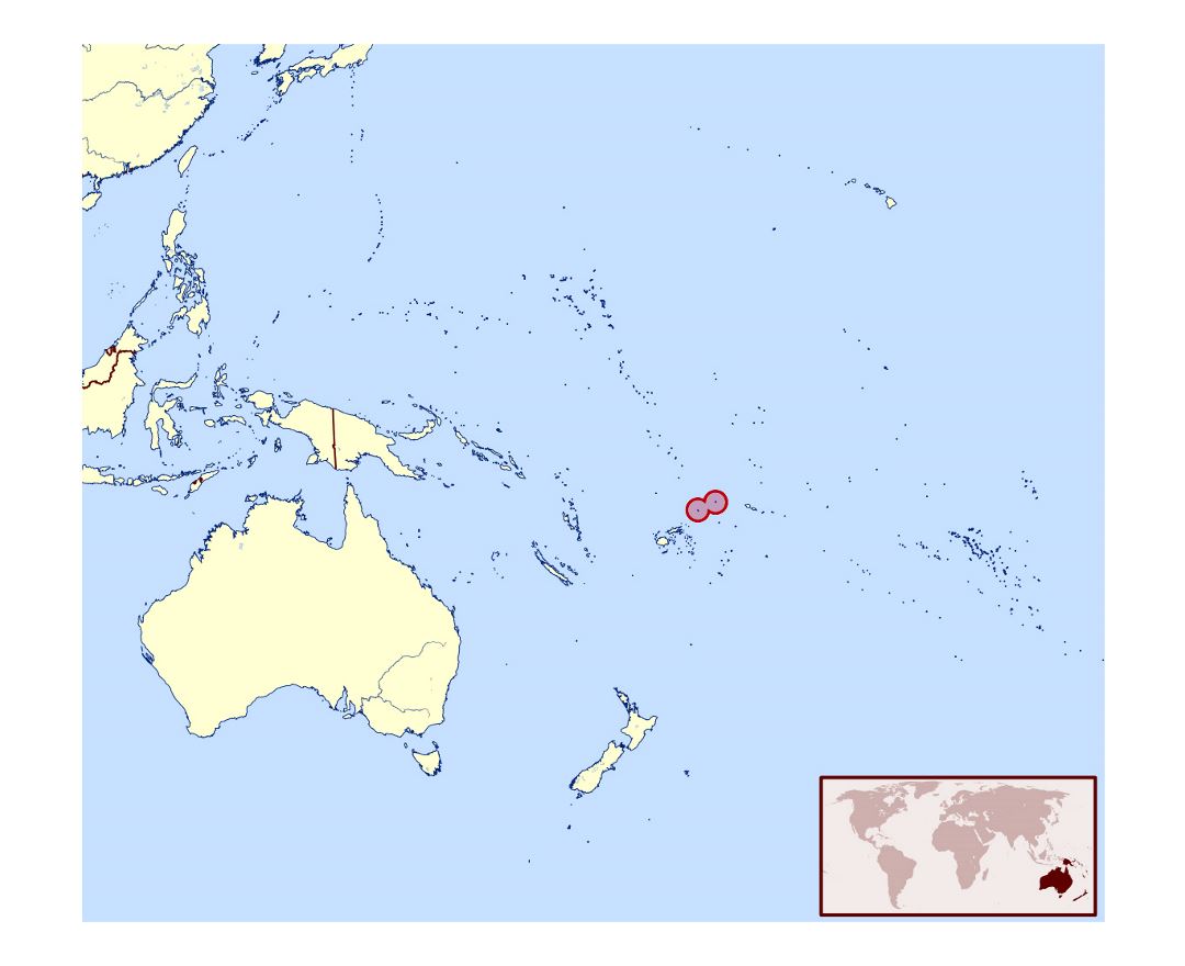
Wallis and Futuna, officially the Territory of the Wallis and Futuna Islands, is a French island collectivity in the South Pacific between Tuvalu to the northwest, Fiji to the southwest, Tonga to the southeast, Samoa to the east, and Tokelau to the northeast. Though both French and Polynesian, Wallis and Futuna is distinct from the entity known as French Polynesia.
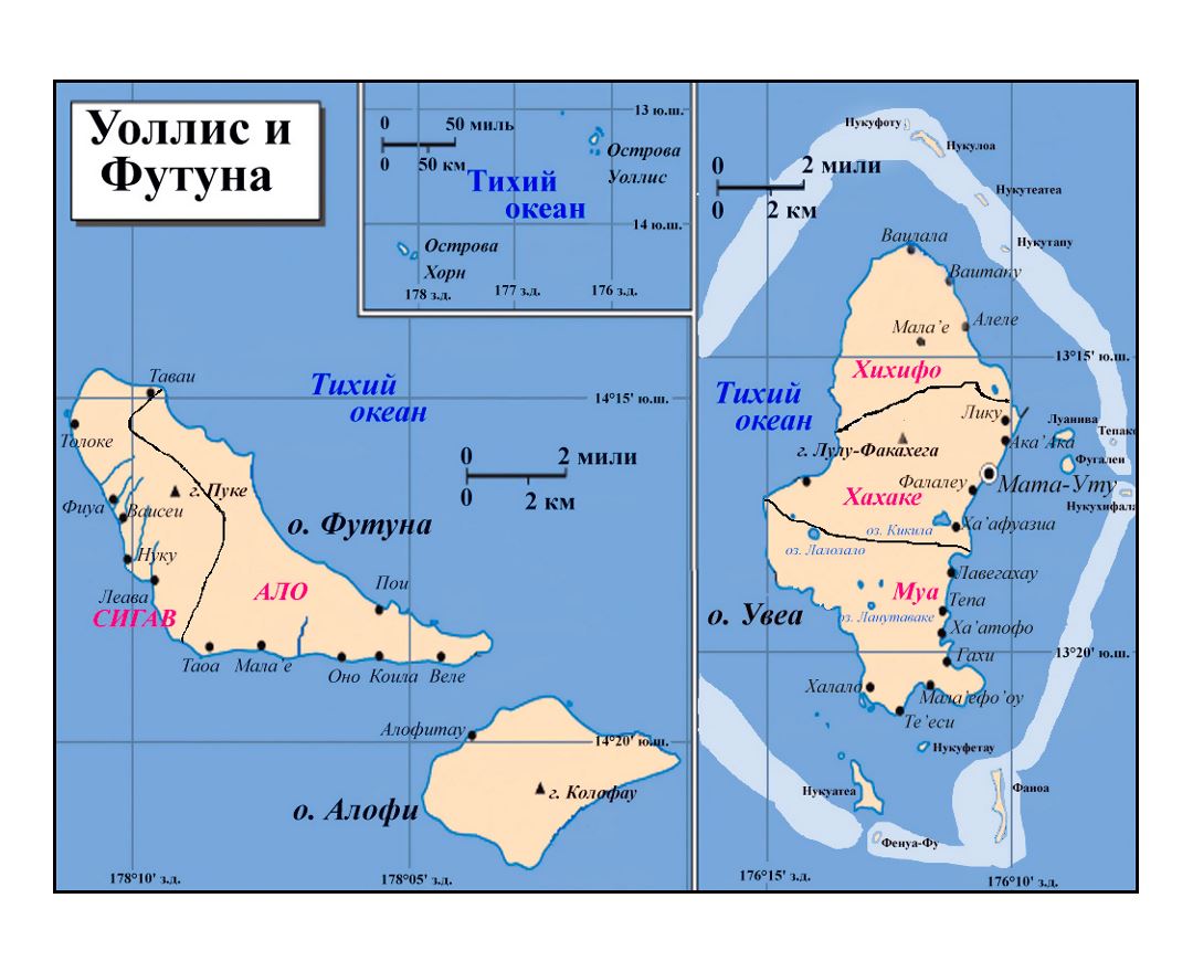
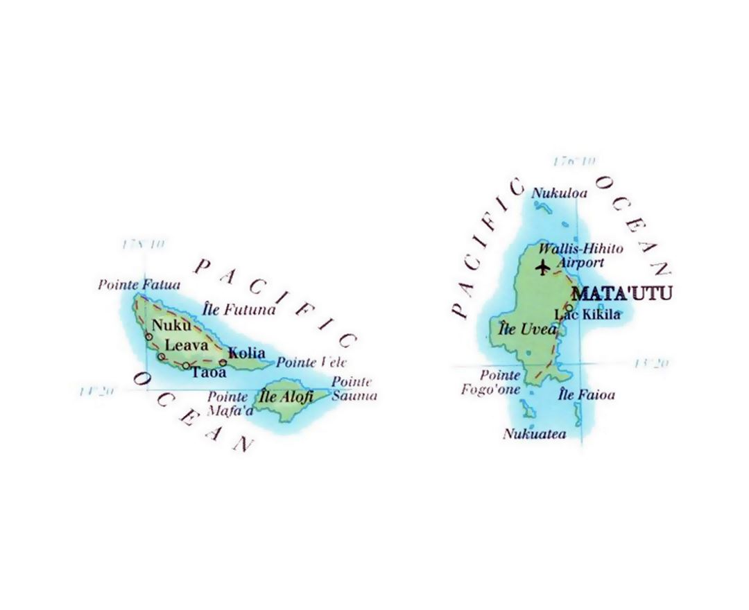
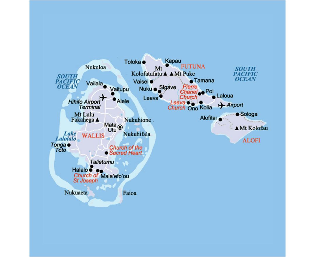
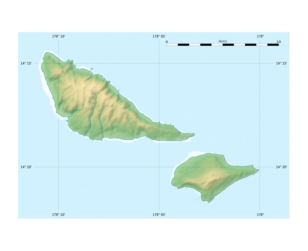
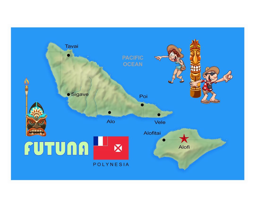
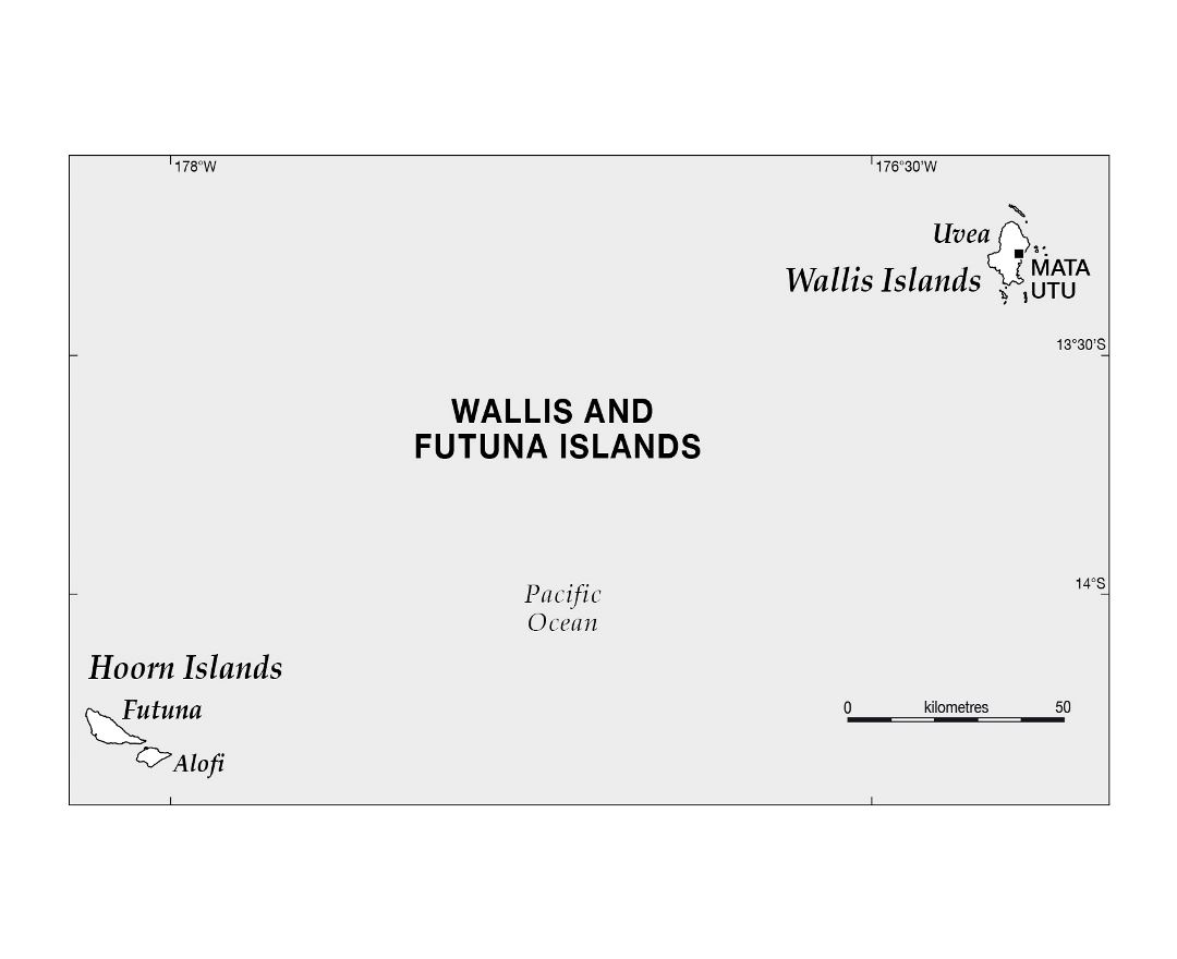
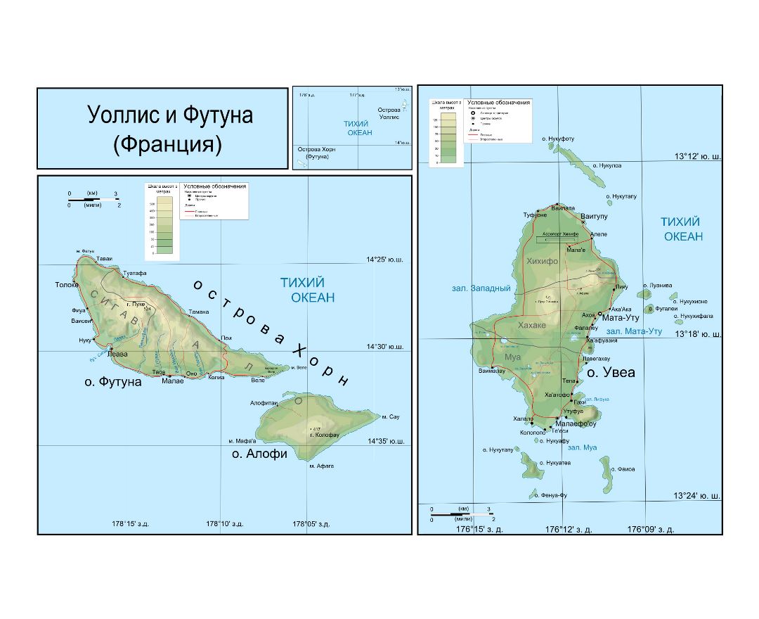
Its land area is 142.42 km² (54.99 sq mi) with a population of about 11,899. Mata-Utu is the capital and biggest city. The territory is made up of three main volcanic tropical islands along with a number of tiny islets, and is split into two island groups that lie about 260 km (160 mi) apart, namely the Wallis Islands (Uvea) in the northeast, and the Hoorn Islands (also known as the Futuna Islands) in the southwest, including Futuna Island proper and the mostly uninhabited Alofi Island.
Since 2003, Wallis and Futuna has been a French overseas collectivity. Between 1961 and 2003, it had the status of a French overseas territory, though its official name did not change when the status changed.